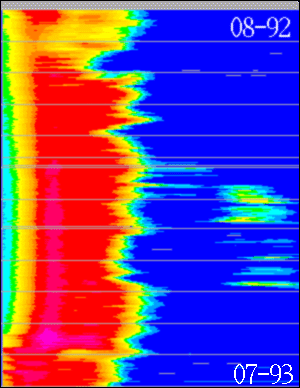
This page shows x-t plots of daily ice edge positions in the Greenland Sea during each of the winters 1992-1993, 1993-1994 & 1994-1995. The figures are derived by extracting ice concentrations from the daily SSM/I F11 maps of total ice concentration.
Each line corresponds to a line from 25W to 5E, sampled every 0.1 deg. longitude.
Larger versions of the images are available by clicking on the small ones on display
Note the Yellow-green area near the right edge during January to April. This is the last time the Odden ice feature in the Greenland Sea has been observed. (Written on December 16, 1995).
The upper line corresponds to August 1, and the bottom line to July 31. Gray lines are inserted every month to facilitate reading. Unfortunately, missing data lines are also gray. (Will be fixed later).
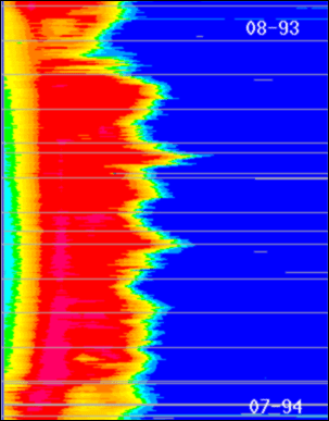
Another full year of ice edge data. No Odden appeared in during this winter. A near minimum ice winter in the Greenland Sea.
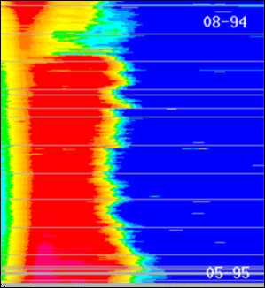
Another near minimum ice year in the Greenland Sea. Note that data are only available until the end of May 1995. New data will incorporated as they become availale.
An ASCII file with the daily data is available as well. The ASCII file has 1/10's of ice concentrations sampled every .5 degree of longitude along 75N.
Images are displayed and manipulated by the DCRS developed EMImage display software.